
DHOLAVIRA, THE HARAPPAN CITY
Harappan Civilization is one of the world’s first great civilizations, which dates back to 3 millennium BC. Through exploration works since 1954, hundreds of Harappan sites were brought to light all over Gujarat and in other parts of India.
The Harappan site at Dholavira (latitude 23²53²110² and longitude 70²13²00²E), has been discovered by Shri Jagatpati Joshi, in 1967-68. The Archaeological Survey of India has started excavations for the first time in 1990 under the directions of Dr. R.S. Bisht.

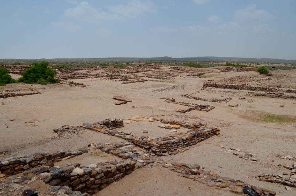
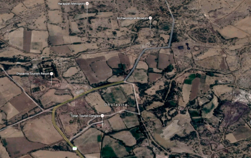
Dholavira is a small village located at a corner of an isolated island of Khadir in the great ran of Kachchh in Bhachau Taluka of Kachchh District, Gujarat. The ancient site known as Kotada (large fort) spans an area of about 100 hectares nearly half of which is appropriated by the fortified settlement of the Harappans.
As a result of the extensive excavations, Dholavira has emerged as a major Harappan city remarkable for its exquisite town planning, monumental structures, aesthetic architecture and amazing water management and storage system. Besides, it has provided a long succession of rise and fall of the first Indian urbanization i.e. Harappan Civilization. The site has a unique distinction of yielding an inscription of ten large sized signs of the Harappan script, indeed the oldest sign board of the world. A variety of funerary structures are yet another significant discovery, indicating the presence of composite ethnic groups in Indus population at Dholavira. The identification of a stadium with seating arrangement and introduction of middle Town added a new feature to the Harappan studies.
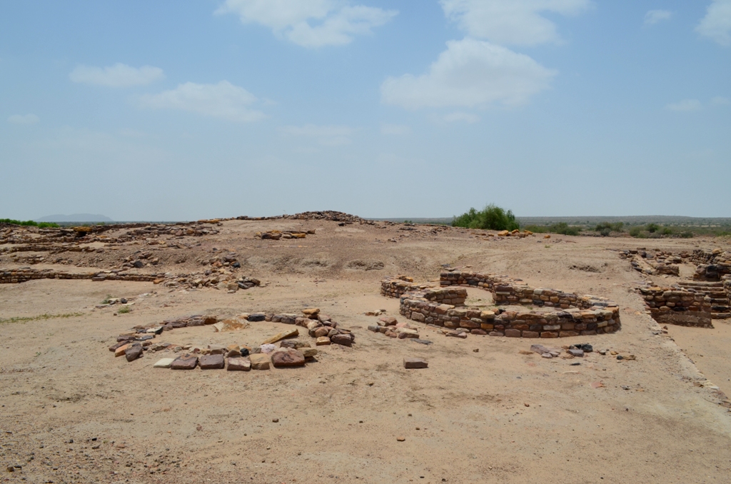
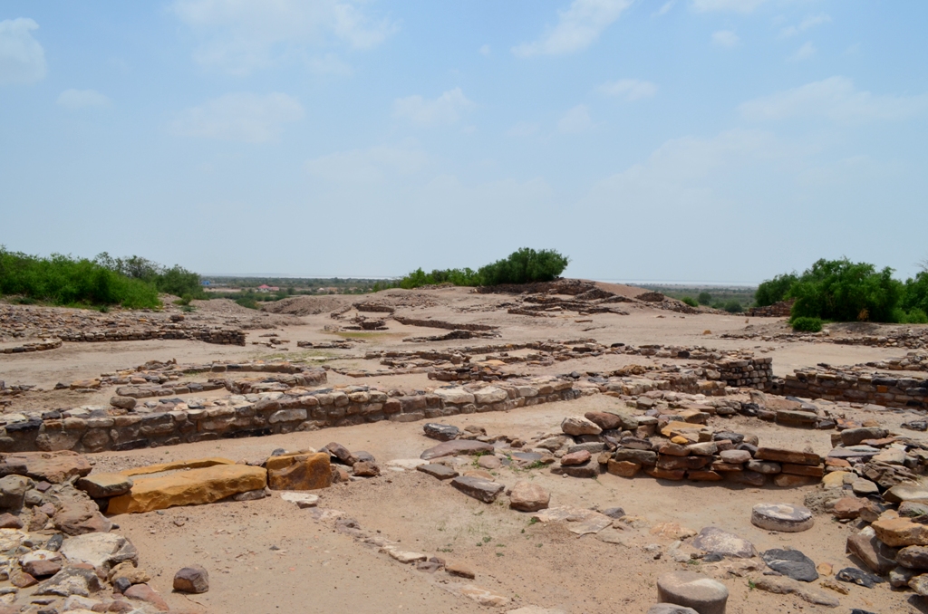

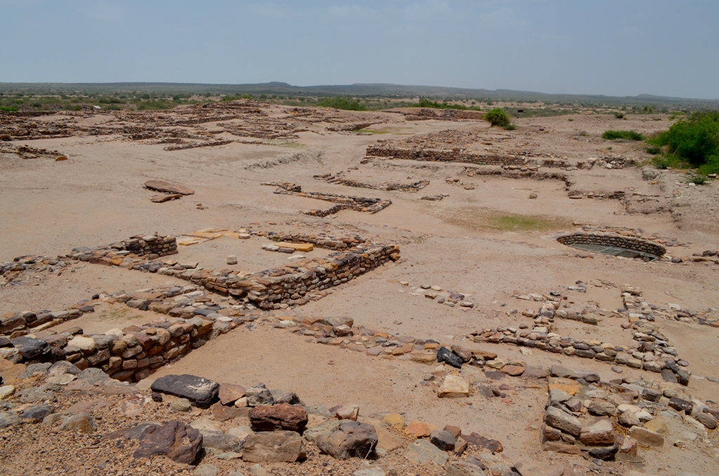
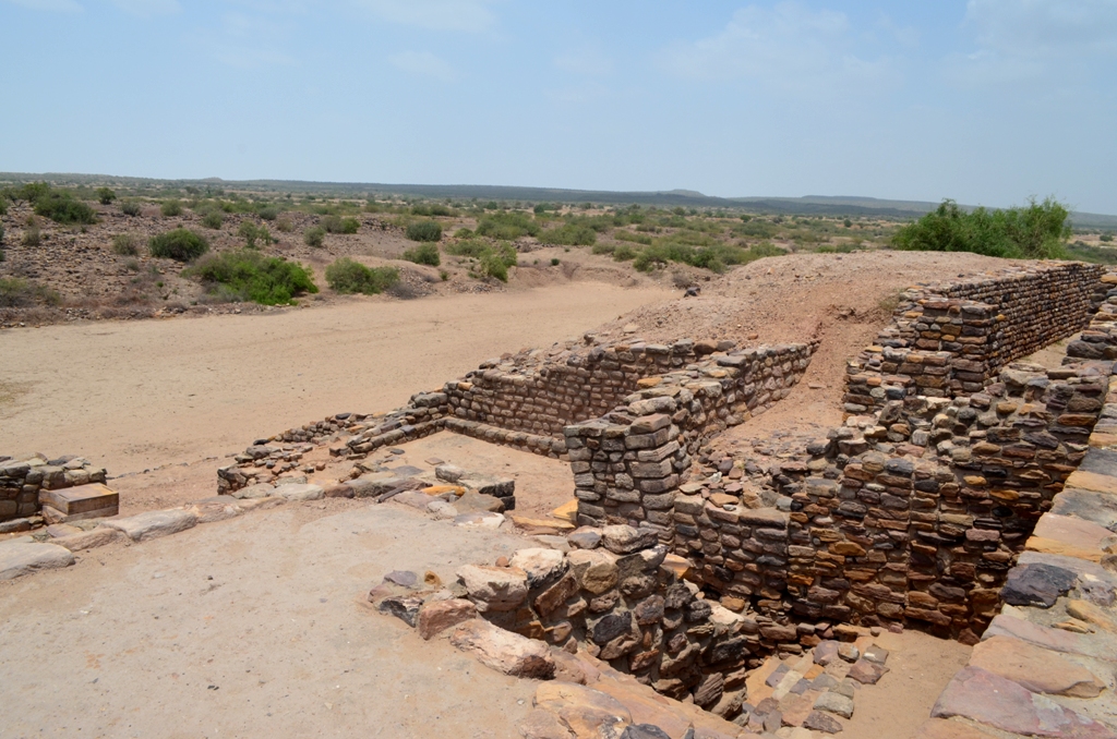
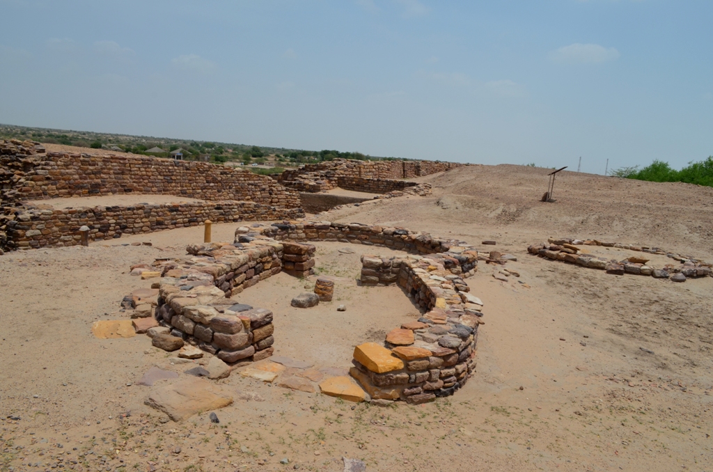
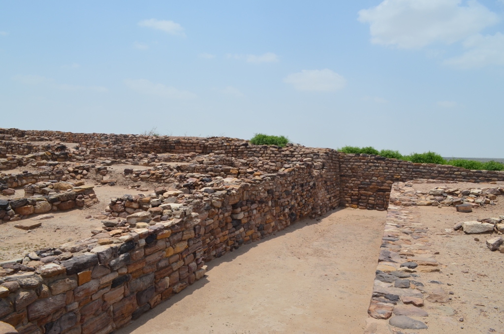
The spectacular city of Dholavira was in the form of a parallelogram guarded by a fortification. The area measuring 771.10 metres in length and 616.85 metres in width encloses three principal divisions i.e. the citadel, the middle town and the lower town.
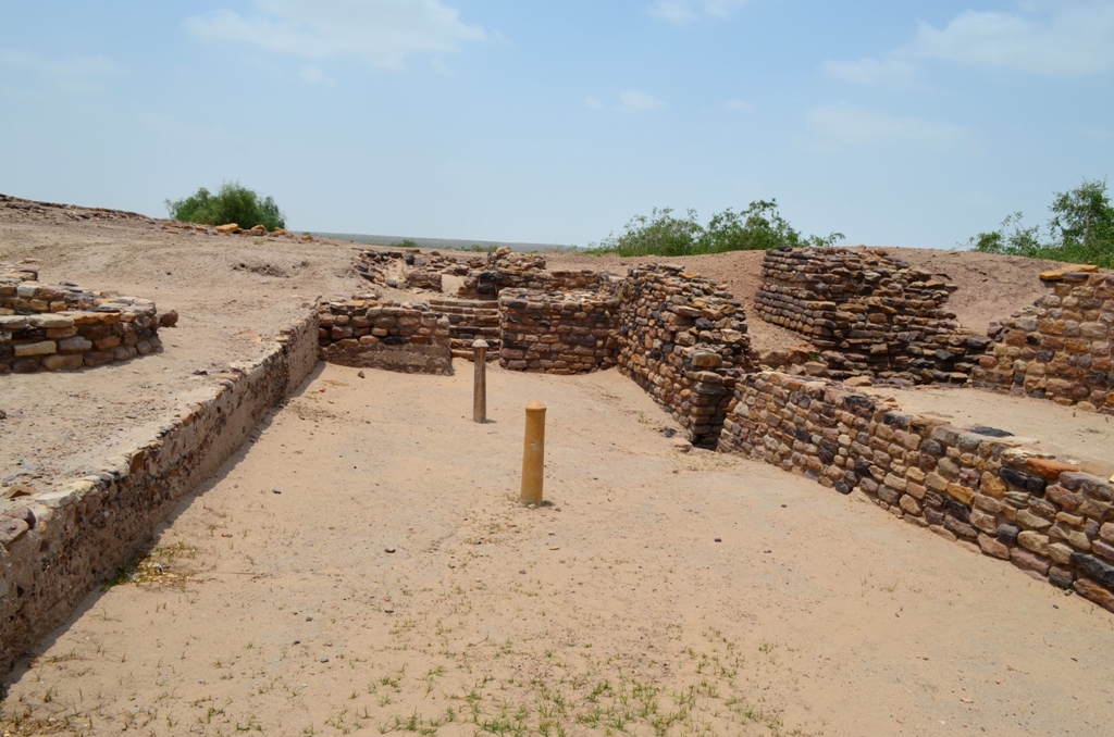
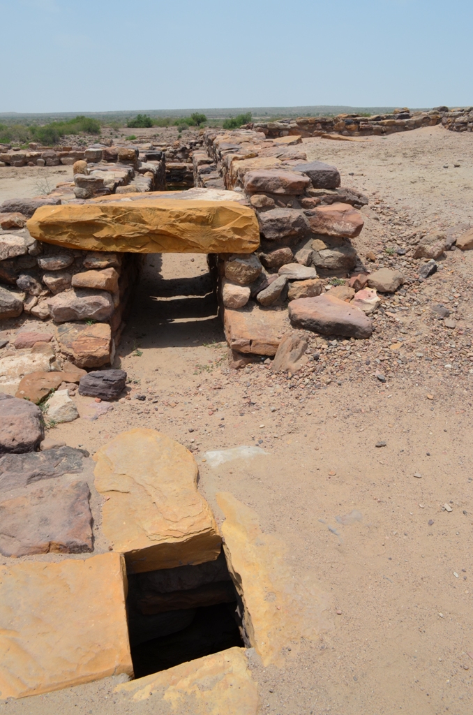
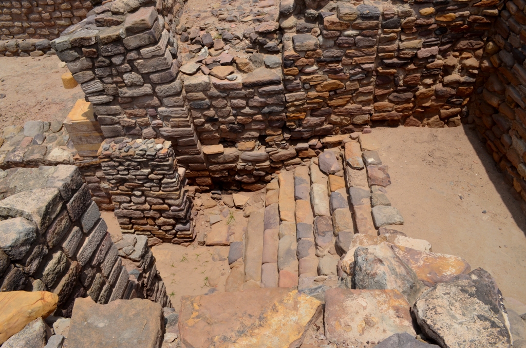
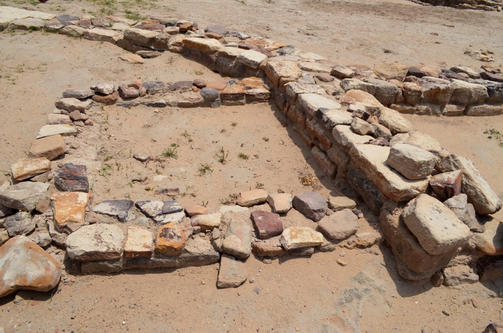
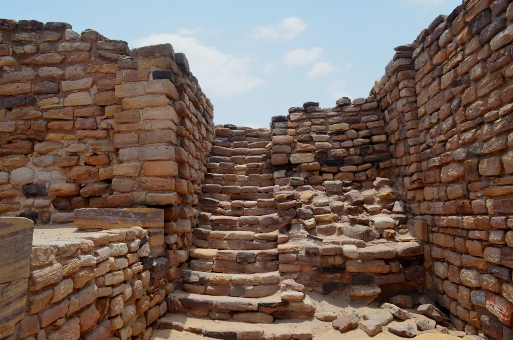
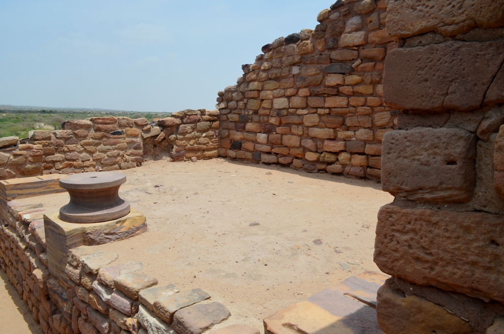
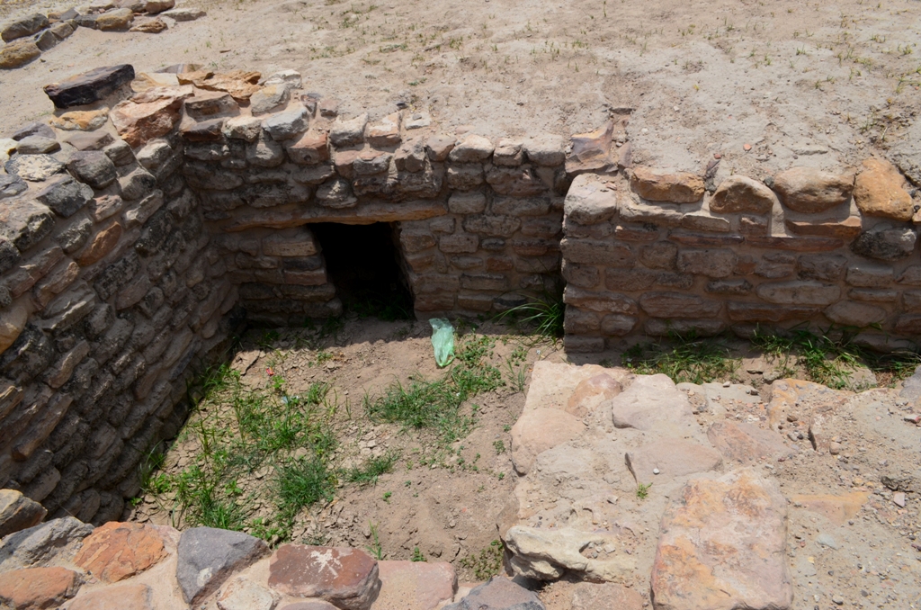
The Citadel standing majestically on the south consists of two fortified divisions, the Castle in the east and the Bailey in the west, the middle town also fortified, lies to the north hand is separated from the citadel by long and wide ceremonial ground. The lower town was laid out within the general fortification to the east of the middle town. In the citadel and middle town area interesting network of drains, both small and large are discovered.


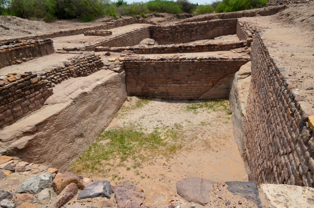
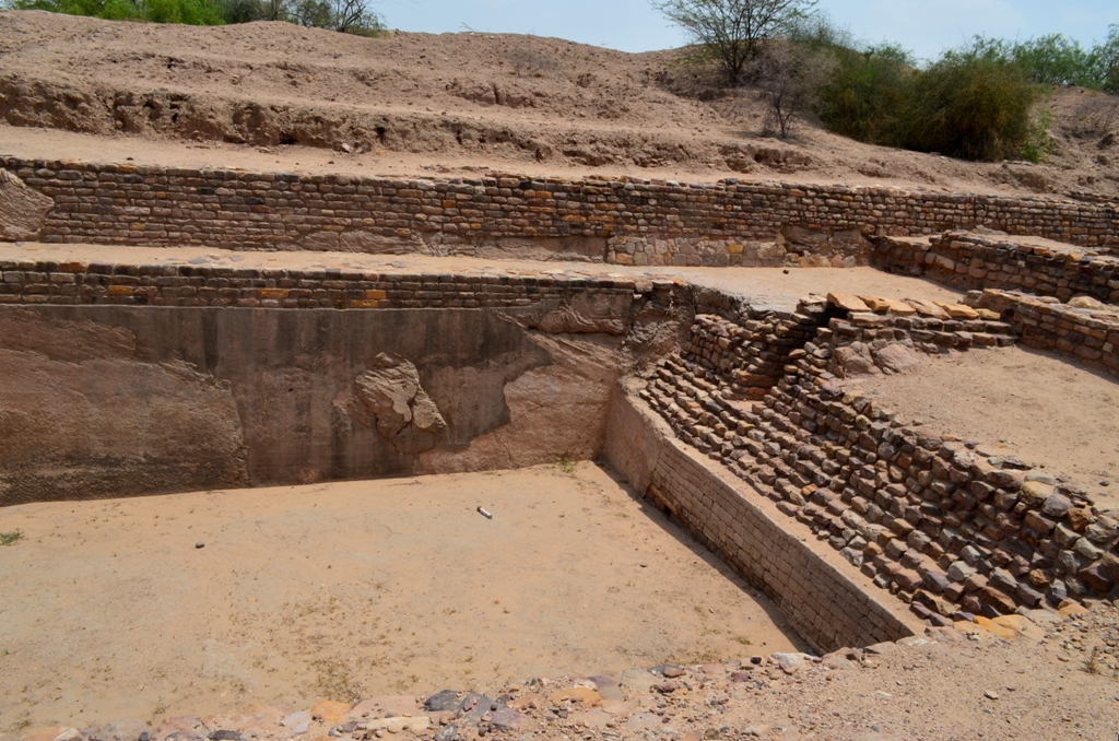

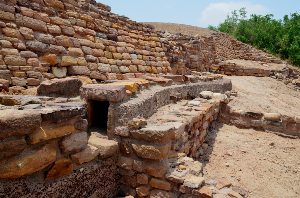
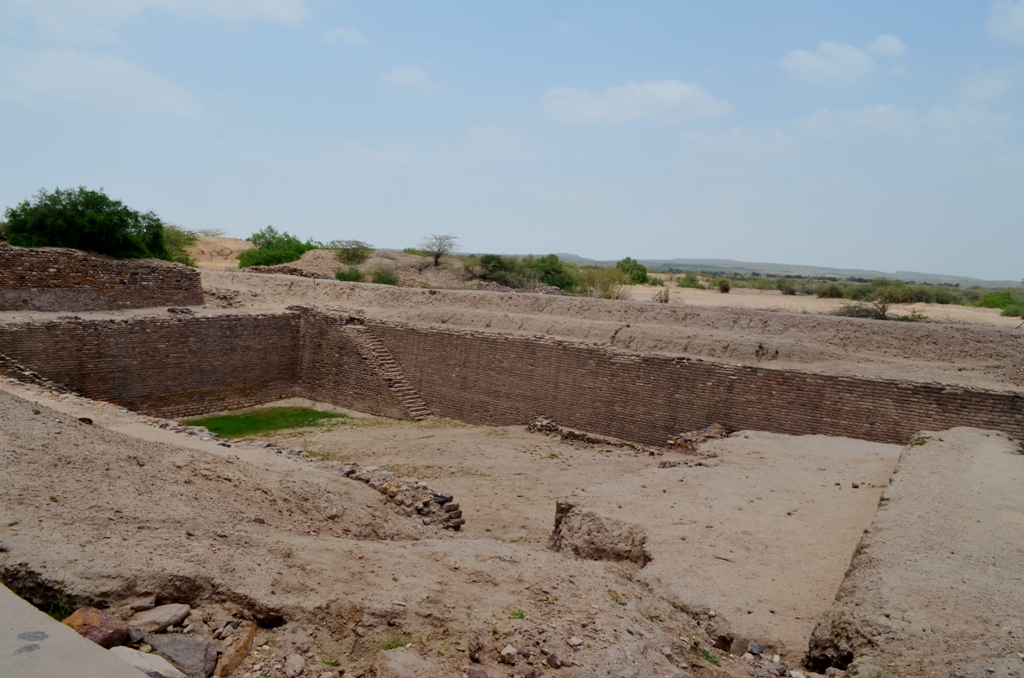
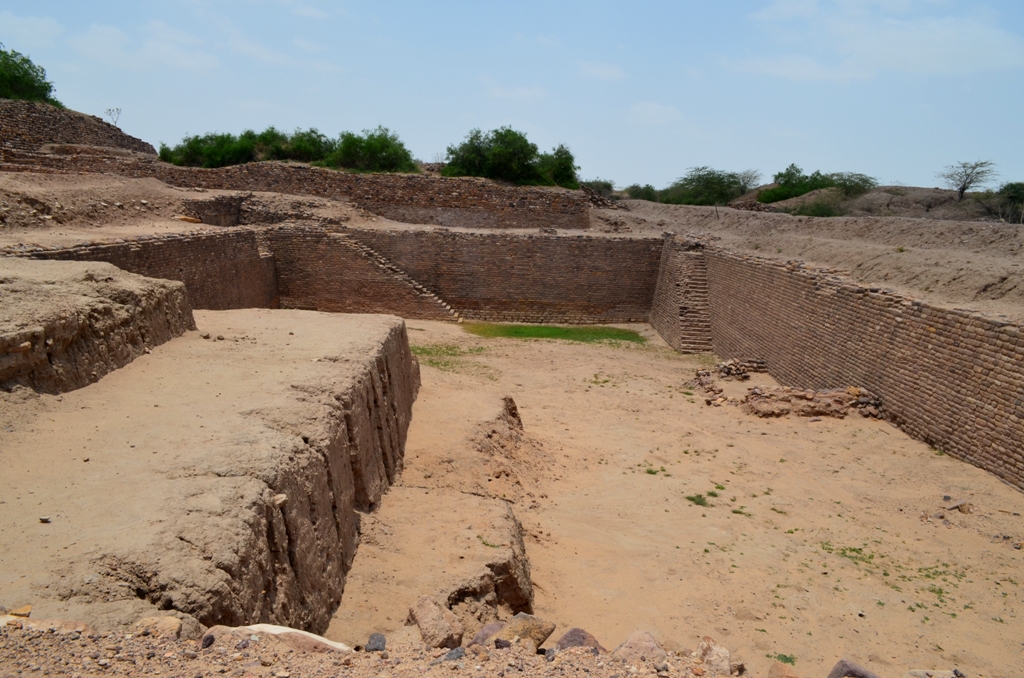
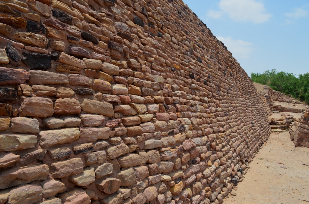
The unique feature of Dholavira is the occurrence of series of reservoirs, of which three are now exposed, theses reservoirs were used for storing fresh water, possibly filled with water diverted from a nearby seasonal Nullah. These reservoirs are partly excavated into the bedrock and partly built of masonry. There is a provision of steps to reach the water level. This system of reservoirs provided fresh water to the flourishing Harappan city in region, where the present day rainfall averages from 300mm to 400mm. very often many seasons may go without rains. This achievement is a high watermark of Harappan enterprise.
The archaeological excavations at the site have revealed seven significant cultural stages documenting the rise and fall of the first urbanization of South Asia.
Stage I starts right from the virgin ground, the first settlers came with advanced ceramic techniques, copper working, lithic industry, bead making, stone dressing and with certain principles of planning and architecture. They constructed a formidable fortification (1m thick at the base) around the settlement. The houses were made of moulded mud bricks of standard sizes.
Stage II is marked by widening of the fortification, increase in ceramic forms, decorations and in the quantity of minor antiquities.
Stage III is a very creative period of Dholavira. The small settlement grew into a large town having two fortified major division in addition to annexes and water reservoirs, all within a peripheral wall.

The existing fortified settlement was in fact made into Citadel and another fortified sub division was added to it on the west. These two sub division have been designated as Castle and Bailey respectively.
Towards the closing decades of Stage III the entire settlement witnessed a natural catastrophe most probably caused by an earthquake of severe magnitude as the tell-tale marks have clearly indicated. Consequently, large scale repairs were executed and significant changes were made in the planning. The city wall was also extended eastwards. At least, during that sub-stage, the monument gateways along with their front terraces had been introduced. Now, the entire settlement reached to its fullest growth. The city scape possessed three principal division, a ceremonial ground and a series of water reservoir all around.
Stage IV belongs to the classical Harappan Culture. The city of Stage III was thoroughly maintained along with the monumental structures such as gateways, fortification walls and the drainage system.
The famous inscription of ten large-sized signs of the Harappan script found in a chamber of North Gate should also pertain to this stage. All the classical Harappan elements such as pottery, seals, lithic tools, beads, weights and other items of gold, copper, stone, shell and clay are now found in abundance. Among most impressive items are elements of functional pillars and free-standing columns made out of locally available limestone.
Stage V is characterized by the general decline particularly in the maintenance of the city as is more vividly reflected in the citadel. However the other items such as pottery, seals, etc. continued in their developed forms and styles. this stage was followed by a temporary desertion of the site.
The following Stage VI presents an entirely different form of the Harappan Culture that has been found widely distributed in other parts of Gujarat. The culture has certainly undergone a drastic transformation by incorporating in it diverse pottery traditions coming from the sites of Sindh, South Rajasthan and Gujarat while many Harappan traditions, albeit in changed form and styles, were still present in pottery, stamp-seals and weights. At Dholavira also, this late Harappan Culture is present. The one time city relapsed into a much smaller settlement with a different inner layout. Having lived there about for a century, the late Harappans abandoned the settlement.
Stage VII people, the new corners appeared to be closely related to their predecessors of the Stage VI as the ceramic assemblages remained the same. Strangely enough, the new people constructed their houses in an entirely new form that is circular. All the urban attributes are conspicuous by their absence.
Thus, the urbanization that made its humble beginnings in Stage I and went on developing through several stages became totally deurbanized by the time of the advent of Stage VII.
The site was never occupied thereafter.
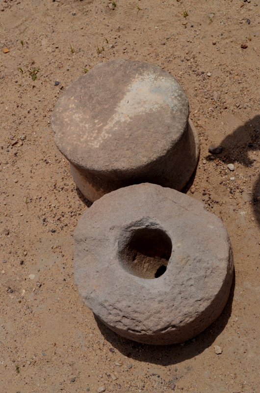
A large number of antiquities were unearthed from the site noteworthy among those are graduated scale made on a charred rib bone of an animal, a number of seals and sealing, beads of semi-precious stones, gold, copper, shell, terracotta, etc. Among the terracotta figurines, the unicorn animal figure is an important discovery of its kind. Gold, silver, copper, shell and terracotta ornaments were in use at that time. A vessel of Chlorite schist and some other antiquities of west Asian origin indicate its link with Mesopotamia.
SIGN BOARD
A board with ten letters, made of Gypsum was found on the Northern Gate of the Castle. It is acclaimed to be the oldest sign board and represent the name and title of the king of the city. Each sign is about 37 cm high and the board on which the letters were inscribed would be about 3 meter long.
THE CITADEL
The Citadel at Dholavira, unlike its counterparts at Mohenjo-Daro, Harappa and Kalibangan but like that at Banawali, was laid out in the South of the city area. Like Kalibangan and Surkotada it had two conjoined fortified subdivisions. Tentatively, christened at Dholavira as Castle and Bailey, located on the East and the west, respectively.
The Castle is the most Zealously Guarded by impregnable defenses and aesthetically furnished with impressive gates, towers, and drainage.
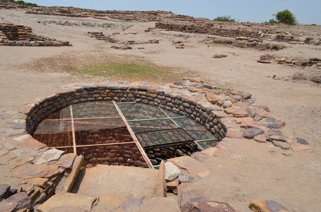
EASTERN RESERVOIR
This on to East of the Castle was found to be the largest, grandest and the best0furnished reservoir. Rectangular in shape, measuring 73.40 m north-south and 29.30 m east-west (ratio 5:2) at the top, while above that there should have been a 1 to 120 m high embankment as evidenced at four corners. Its floor was excavated into three levels. The deepest of which was 10.60m as has been ascertained so far at three corners (NW. NE & SW) it was provided with a flight of 30 steps each.
Inside this water structure there was found a rock cut well with a few rock cut steps and a stone enclosure of a later date.
BAILEY
The part is adjacent to the west of the Castle which served as a Residential Complex for the important people, possibly the officials.
(TEXT SOURCE: ARCHAEOLOGICAL SURVEY OF INDIA)